Drones
Arch Scales
Narrow Your Results
Main Category
Sub Category
Mfr / Trade Name
- List View
- Gallery View
| Page of 1 |


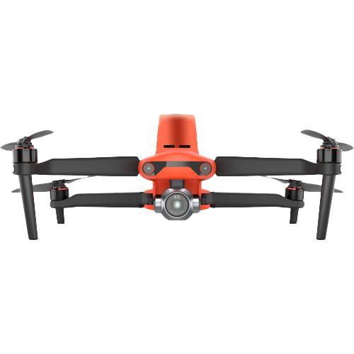
Autel EVO II Pro 6K RTK V3
Item No. CRL8070.070.001
TheEVO II Pro RTKprovides a proven, accurate, durable, and user-friendly,FAA Remote ID CompliantUnmanned Aircraft System (UAS) for numerous applications, including the creation ofsurfaces,point clouds, andorthoimageswithCarlson PhotoCapture, as well asfeature extractionandCAD planswithCarlson Point Cloud. Available in packages with both PhotoCapture and Carlson Point Cloud to take your aerial data to finished deliverables, the EVO II Pro offers up to 36 minutes of flight time, high accuracy positioning with its detachable RTK module, a 20MP camera with 1&Prime sensor, and built-in mission planning for simple setup in the field.


")
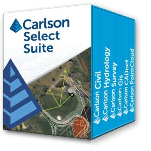
Carlson Select Suite (Civil, Survey, Hydrology, GIS)
Item No. CRL2026.001.001
The Carlson Select Suite isa complete suite of solutions for land development professionals across the disciplines of drafting, land surveying, engineering design and construction estimating.Select Suite users are able to pick and save between two and six modules in order to fit their specific needs and specialization. The eligible modules are Survey, Civil, Hydrology, GIS, CADnet, and Point Cloud Basic. ASK US WHAT YOU CAN DO WITH CARLSON CIVIL SUITE!